 ※タッチするとサイトに移ります。

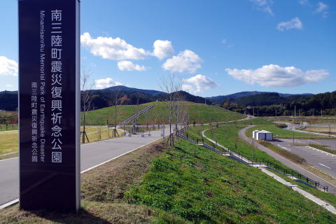
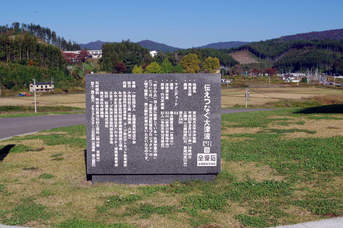
宮城県南三陸町 Minamisanriku Town, Miyagi Prefecture October 29, 2022
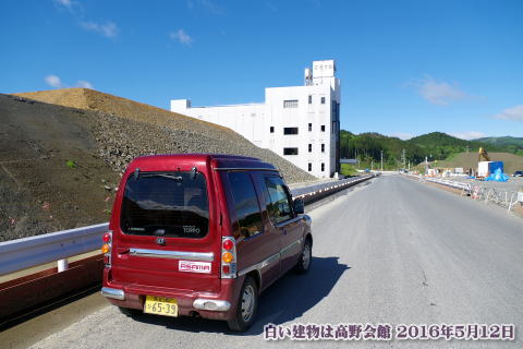
2016年5月に訪れた時、私はこう書いている「津波で押し流された街の荒野にポツンとそびえていた南三陸町防災庁舎。震災遺構として保存が決まった。しかし防災庁舎は、かさ上げ台地の造成工事で遠くから見ることができない。辺りを見渡せない、かさ上げ台地の下の道路からは、近くまで行かないと見えないのだ。キリコの看板も無い、カーナビは役に立たず、どこを走っているのかさえも分からない。大きな台形で囲まれた防災庁舎は小さく見えた。」
When I visited in May 2016, I was told, “The Minamisanriku Town Disaster
Prevention Office, which stood alone in the wilderness of the town swept
away by the tsunami, was decided to be preserved as an earthquake disaster
remnant. You can't see it from afar because of the construction work in.
You can't see it from the road under the raised plateau, where you can't
see the surroundings, unless you go close.
There is no Kiriko signboard, the car navigation is useless, and I don't even know where I'm running. Surrounded by a large trapezoid, the disaster prevention agency building looked small.
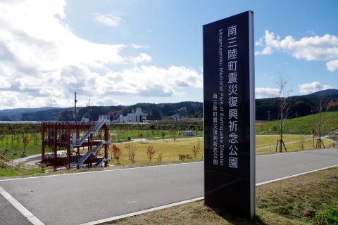
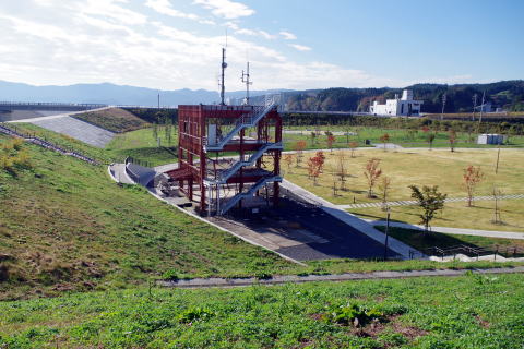
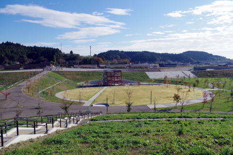
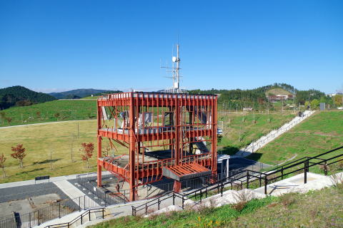
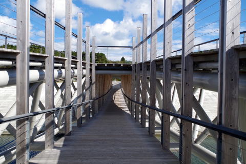
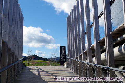
そして今、南三陸町は震災復興祈念公園と南三陸さんさん商店街、今年の10月1日に開館した「南三陸311メモリアル」の津波伝承施設。インフラ整備もされ、かさ上げした大地に新しい住宅街ができ、町は復興している。
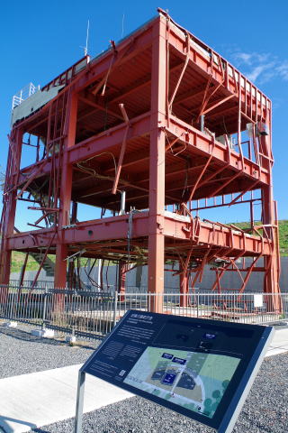
記憶に残る「旧南三陸町防災庁舎」は震災遺構として震災復興祈念公園の津波伝承のシンボル的な存在として、津波で破壊され、へし曲がった鉄骨の骨格の無言の姿で立っている。最後まで防災無線で放送していた女性職員、屋上のアンテナにつかまって助かった人、流された人。当時の様子がTV映像でフラッシュバックする。
And now, Minamisanriku Town is home to the Earthquake Reconstruction Memorial
Park, Minamisanriku Sansan Shopping Street, and the Minamisanriku 311 Memorial,
a tsunami lore facility that opened on October 1. Infrastructure has been
developed, new residential areas have been created on the raised land,
and the town is recovering.
The memorable "Former Minamisanriku Town Disaster Prevention Office" stands as a symbol of the tsunami lore of the Earthquake Reconstruction Memorial Park as an earthquake disaster remnant, a silent figure of a bent steel frame that was destroyed by the tsunami. Some people were saved by holding on to the antenna on the roof, and some were swept away.
I have flashbacks of TV footage from those days.
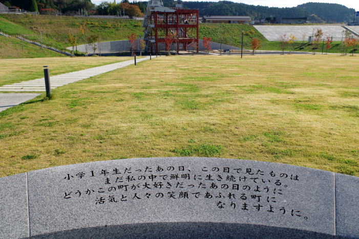
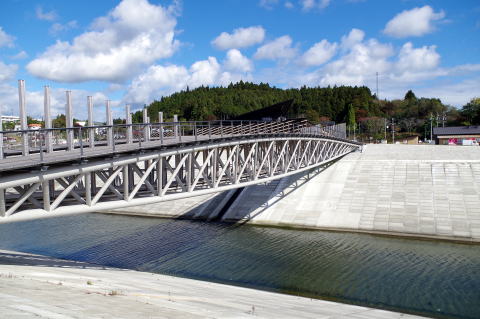
<南三陸町震災復興祈念公園>Earthquake Reconstruction Memorial Park
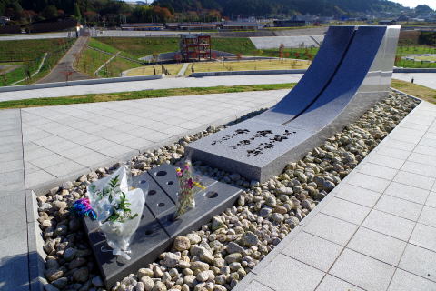
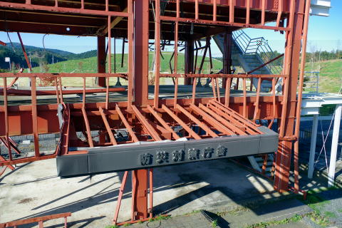
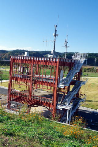
震災遺構「南三陸防災庁舎」
防災対策庁舎は海抜1.7m、海岸から約600mの地点に建つ鉄骨造ほか3階建てであり、地上から高さ約12メートルの屋上に避難場所があった。2005年(平成17年)10月1日、志津川町と歌津町が新設合併して南三陸町となった。防災対策庁舎は南三陸町役場の行政庁舎の1つとなった。町役場の本所には、行政第1・第2庁舎、そして防災対策庁舎が隣接して建っていた。
2011年(平成23年)3月11日に発生した東北地方太平洋沖地震(東日本大震災)に伴う15.5メートルの津波により、第1庁舎および第2庁舎は流失し、防災対策庁舎は骨組みと各フロアの床および屋根等を残して破壊された。
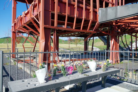
宮城県南三陸町は市街地が壊滅。831人が犠牲になった。あの日、町防災対策庁舎で指揮を執っていた町長の佐藤仁(69)も屋上で津波にのまれ、死にかけた。そして、職員ら43人も失った。
The disaster prevention government building was 1.7m above sea level, and was a three-story building with a steel frame standing about 600m from the coast. On October 1, 2005, Shizugawa Town and Utatsu Town merged to form Minamisanriku Town. The disaster prevention office building became one of the administrative buildings of the Minamisanriku town office. Adjacent to the main office of the town hall were the first and second administrative buildings, as well as the disaster prevention office.
The 15.5-meter tsunami caused by the Great East Japan Earthquake that occurred on March 11, 2011 (Heisei 23) destroyed the 1st and 2nd Government Buildings. It was destroyed leaving only the floor and roof of the building.
The town of Minamisanriku in Miyagi Prefecture was completely destroyed. 831 people were killed. On that day, Mayor Hitoshi Sato (69), who was in command of the town's disaster prevention office, was swallowed by the tsunami on the roof and nearly died.
And 43 Minamisanriku Town Hall employees were also lost.

※参考ウェブサイト
https://ja.wikipedia.org/wiki/%E5%8D%97%E4%B8%89%E9%99%B8%E7%94%BA%E9%98%B2%E7%81%BD%E5%AF%BE%E7%AD%96%
E5%BA%81%E8%88%8E
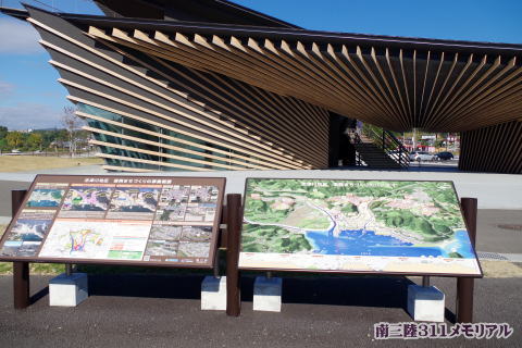
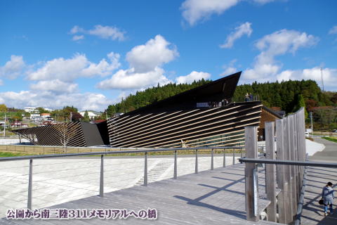
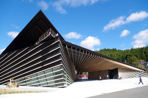
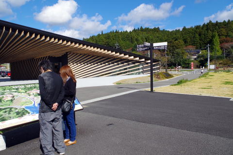
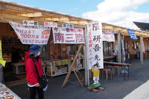
<南三陸311メモリアル(隈研吾 設計)&さんさん商店街>
<Minamisanriku 311 Memorial(Designed by Kengo Kum)&Sansan Shopping Street>
南三陸311メモリアルは、隈研吾の設計した南三陸町東日本大震災伝承館である。東日本大震災の経験を共有し「自然とは、生きることは」に思いを馳せ語り合う施設。
The Minamisanriku 311 Memorial is the Minamisanriku Town Great East Japan Earthquake Memorial Museum designed by Kengo Kuma. A facility where people share their experiences of the Great East Japan Earthquake and think about what nature means and what it means to live.
南三陸311メモリアル:https://m311m.jp/
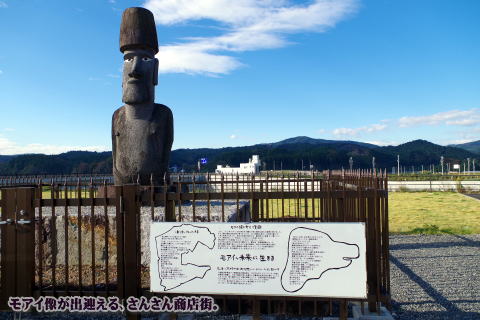
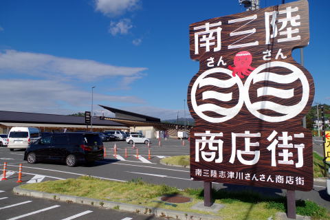
南三陸さんさん商店街(南三陸志津川福興名店街運営組合)
津波によって市街地のほとんどが壊滅した中、地元 商業者はいち早く「福興市」を開催、復興を目指す町民 の意識高揚に多大な効果をもたらした。その実績を基
に、平成24年2月25日に南三陸さんさん商店街が発足。何度か場所を変え復興公園に隣接する場所に落ち着いた。
While most of the city was destroyed by the tsunami, local merchants were among the first to hold the “Fukko Market,” which had a great effect in raising the awareness of the townspeople who were aiming for reconstruction. Based on these achievements, on February 25, 2012, Minamisanriku Sansan Shopping Street was established.
※南三陸さんさん商店街<4D6963726F736F667420576F7264202D20332093EC8E4F97A482B382F182B382F18FA493588A58>
(meti.go.jp)
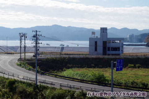
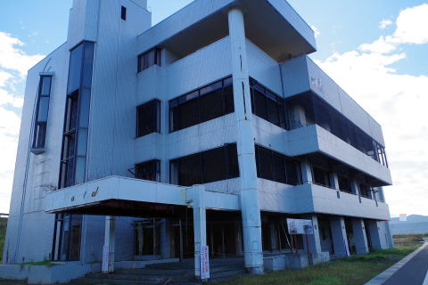
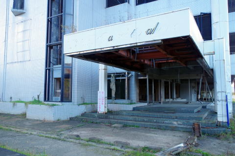
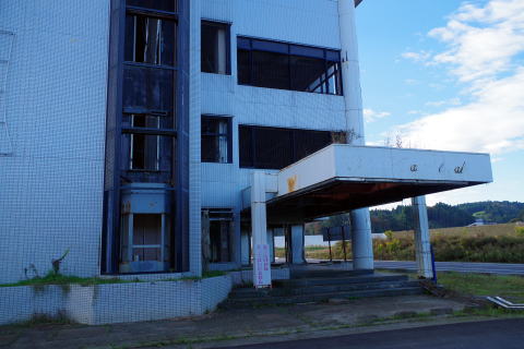
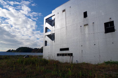
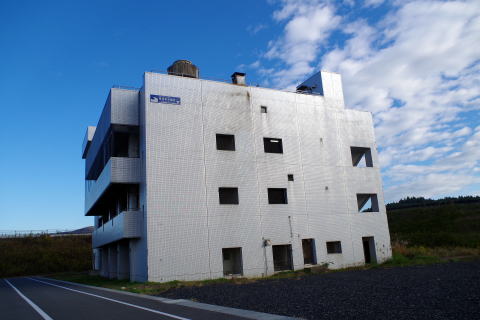
震災遺構「ブライダル高野会館」Earthquake remains "Bridal Takano Kaikan"
荒廃した大地にポツンとそびえ立つ、元結婚式場の高野会館。華やかな施設だったに違いない、エントランスも崩壊し、外を見渡せるエレベーターも無残な姿に…。
周りはかさ上げした大地になり、被災した高野会館は窪地にポツンと取り残され当時を偲ばせる。
The Takano Kaikan, a former wedding hall, stands alone in the ruined land. The entrance, which used to be a glamorous facility, has collapsed, and the elevator that overlooks the outside is in a tragic state.
Surrounded by raised ground, the damaged Takano Kaikan was left in a hollow,
reminiscent of those times.

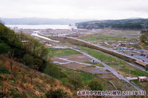
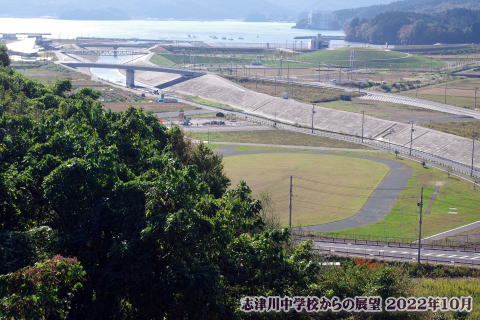
志津川中学校からの展望View of the town from Shizugawa Junior High School
震災2年後の景色と現在では、川の形状も土地の形状も大きく変わった。
The shape of the river and the shape of the land have changed greatly between the scenery two years after the earthquake and the current scenery.